An independent history of Haslet, Tarrant County, Texas

Looking for city services? The official site is haslet.org

Timetable
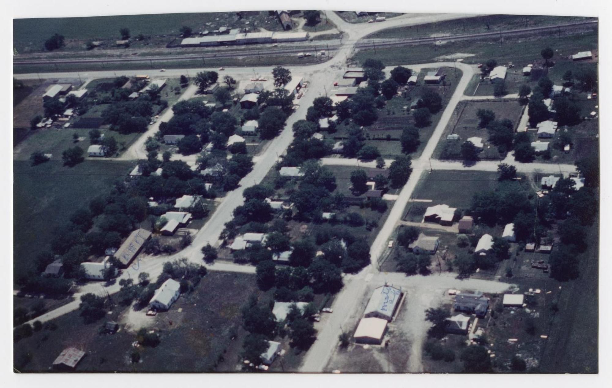
An aerial color photograph of a small town grid: tree-lined streets, scattered houses and low buildings, and a railroad line running across the top.

June 1983

Haslet from the air, 1983

Haslet from the air in June 1983, six years before Alliance Airport opened. The railroad runs across the top of the frame.

Archive title
[Aerial Photograph of Haslet, Texas in 1983]
Archive description
Aerial photograph of parts of Haslet, Texas; this photo shows approximately five streets and a number of buildings along them.
Era
Incorporation
Credit
Courtesy of Haslet Public Library via The Portal to Texas History, UNT Libraries
Rights
The contents of The Portal to Texas History (digital content including images, text, and sound and video recordings) are made publicly available by the collection-holding partners for use in research, teaching, and private study. For the full terms of use, see https://texashistory.unt.edu/terms-of-use/
Cite as
[Aerial Photograph of Haslet, Texas in 1983], photo, 1983-06; (https://texashistory.unt.edu/ark:/67531/metapth744194/: accessed September 24, 2026), University of North Texas Libraries, The Portal to Texas History, https://texashistory.unt.edu; crediting Haslet Public Library.
View the original record at The Portal to Texas History